-
 Point Molate Pier
Gordie, is this the pier that is being removed, or am I looking in the wrong place?

-
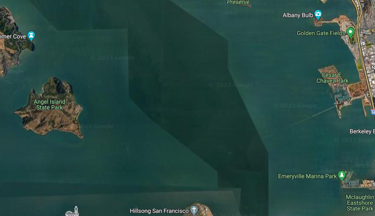
What is the black box off the Pt Molate Pier? This black box appears in the Round the Rocks Sailing Instructions, revision 2.
-
Great question, and posting here means at least some other people who could have the same question can see the answer.
Let me confirm: is this the "black box" you are referring to, in the document titled 2022-03-16 18:00: Round the Rocks Sailing Instructions Revision 2 is Posted ?

If so, that's probably a tile from a different pass.
Google maps satellite view works by buying imagery from companies like Maxar, and then breaking the images at each zoom level into little tiles that are easily loaded from the web. That way when you scroll the map sideways they just have to load enough tiles to fill the side of the screen and it appears smooth to you, and as you zoom in they load the tiles for the next zoom level so detail keeps increasing.
But they don't buy new images all the time --- images are expensive --- and so they prioritize getting new land images and leave seas, lakes and bays alone. I don't know why it happened here, but I believe you're looking at a cloudy-day tile getting shown next to sunny-day tiles.
Usually it shows up in the middle of a bay or lake, like this:
Here's the area by the Dumbarton bridge:

If you look you can see different tide cycles, and the shadows on the electrical towers in the top center do not (seem to) match the shadow on the pivoted section of the railroad bridge, which are giveaways that this is a composite image from two or more satellite passes.
Google maps is a fascinating, free service.
Richard, 2023 SSS Race Co-Chair
 Posting Permissions
- You may not post new threads
- You may not post replies
- You may not post attachments
- You may not edit your posts
-
Forum Rules

 Race Chair 0.5

 Reply With Quote